The Role of Geographic Information Systems (GIS) in Archaeology
Geographic Information Systems (GIS) have completely transformed the field of archaeology, offering a powerful set of tools for analyzing spatial data and gaining new insights into past civilizations. By harnessing the capabilities of GIS technology, archaeologists can now visualize, interpret, and analyze archaeological data in ways that were previously unimaginable.
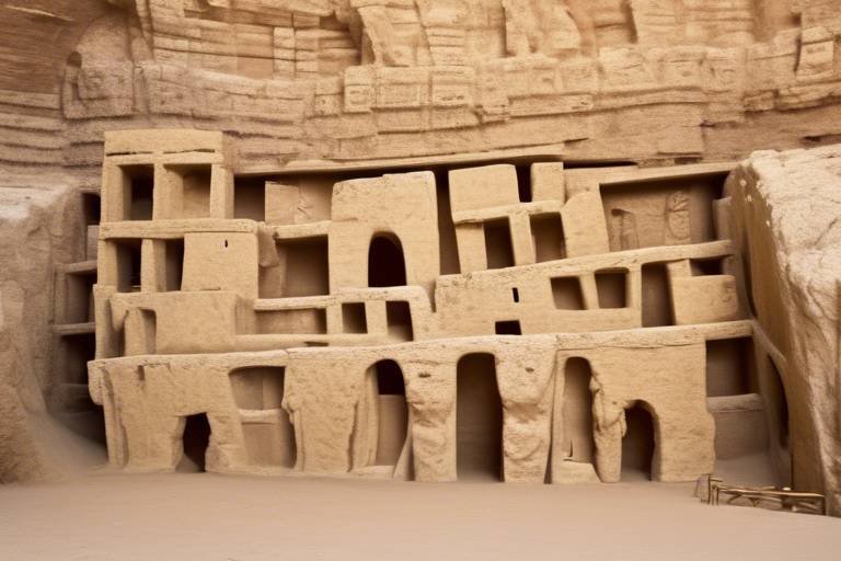
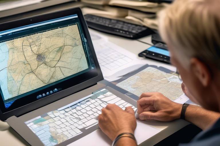
One of the key applications of GIS in archaeology is the mapping of ancient sites. Through GIS technology, researchers can create detailed maps that provide a comprehensive view of the layout, relationships, and distribution of artifacts within a specific area. These maps offer valuable insights into the organization of ancient settlements and the interactions between different features.
GIS tools also play a vital role in site discovery and reconnaissance. By analyzing landscape features, topography, and environmental data, archaeologists can identify potential archaeological sites with greater accuracy. This analytical approach helps pinpoint areas that are likely to contain cultural remains, guiding researchers in their exploration and excavation efforts.
Furthermore, GIS facilitates environmental analysis in archaeology by allowing researchers to assess the impact of environmental factors on past human settlements. By studying changes in climate, vegetation, and water sources, archaeologists can gain a deeper understanding of how ancient societies adapted to and interacted with their natural surroundings.
Another significant use of GIS in archaeology is predictive modeling. By integrating archaeological data with GIS technology, researchers can develop models that predict the location of undiscovered sites based on known patterns of settlement, land use, and resource availability. This predictive approach helps focus archaeological efforts and maximize the chances of uncovering new archaeological treasures.
Heritage management and conservation also benefit greatly from GIS applications. GIS tools aid in the documentation, preservation, and monitoring of archaeological sites, contributing to the safeguarding of cultural heritage for future generations. By digitally mapping and tracking changes in archaeological sites, researchers can ensure their protection and sustainable management.
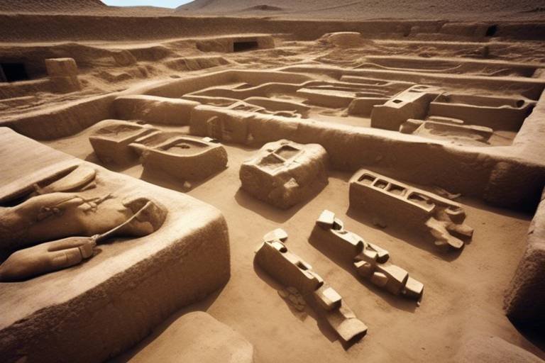
Spatial analysis of artifacts is another area where GIS shines in archaeology. Through spatial analysis, archaeologists can study the distribution patterns of artifacts within a site, shedding light on trade networks, social structures, and cultural practices of ancient societies. GIS technology enables researchers to uncover hidden connections and narratives that may have been overlooked without spatial analysis.
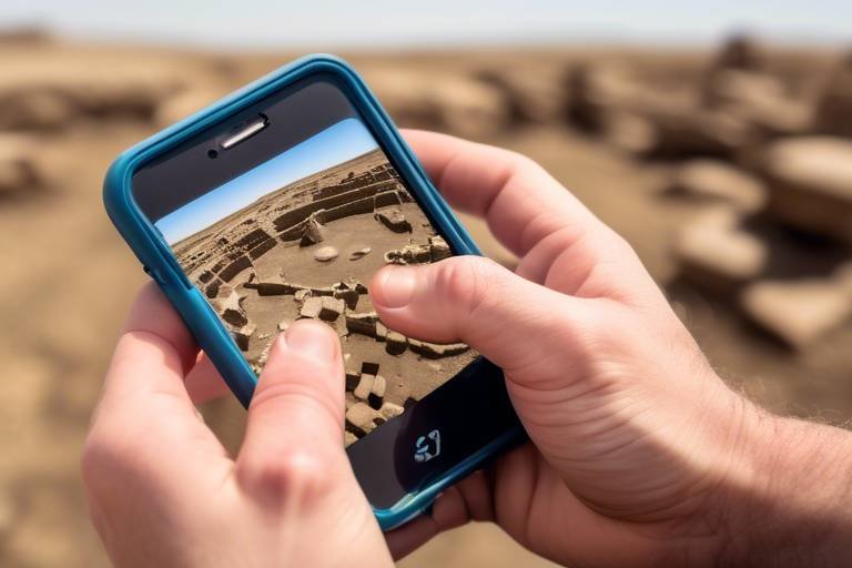
Remote sensing and aerial photography, when combined with GIS technology, offer archaeologists a unique perspective on archaeological sites. By utilizing remote sensing techniques and aerial imagery, researchers can identify features that are not visible on the ground, aiding in the exploration and documentation of hidden archaeological sites. This aerial viewpoint complements traditional ground-based surveys, providing a more comprehensive understanding of archaeological landscapes.
Lastly, GIS enables the creation of interactive 3D visualizations and reconstructions of archaeological sites, enhancing the presentation of research findings and offering immersive experiences for scholars and the public alike. By visualizing archaeological data in three dimensions, researchers can convey complex information in a more accessible and engaging manner, bringing the past to life in vivid detail.

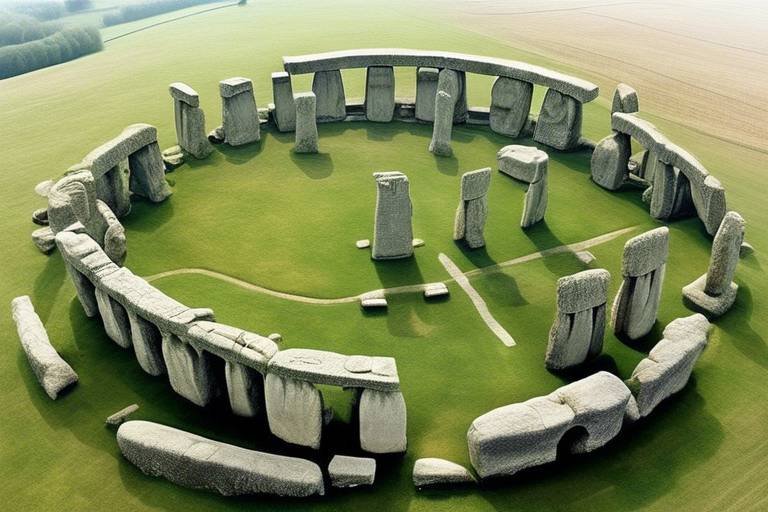
Mapping Ancient Sites
Geographic Information Systems (GIS) have revolutionized archaeological research by enabling the visualization, analysis, and interpretation of spatial data. This article explores the various applications of GIS in archaeology and how it has enhanced understanding of past civilizations.
GIS technology allows archaeologists to create detailed maps of ancient sites, providing valuable insights into the layout, relationships, and spatial distribution of artifacts and features within a given area. By utilizing GIS tools, researchers can uncover hidden patterns and connections that may not be apparent at first glance. These maps serve as a crucial tool in piecing together the puzzle of ancient civilizations, offering a bird's eye view of how these societies were structured and interacted with their environment.

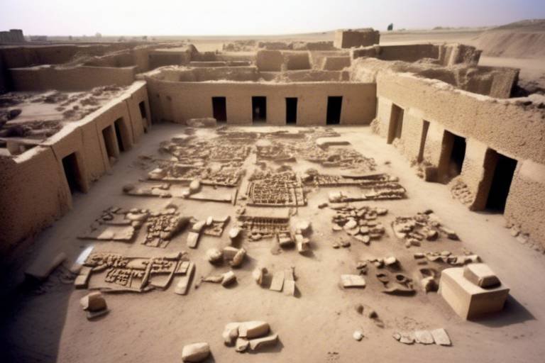
Site Discovery and Reconnaissance
Site discovery and reconnaissance are fundamental aspects of archaeological research, and Geographic Information Systems (GIS) have significantly enhanced the efficiency and accuracy of these processes. By harnessing the power of GIS tools, archaeologists can analyze a wide range of geographical data to identify potential archaeological sites with precision and insight.
One of the key advantages of using GIS for site discovery is its ability to analyze landscape features, topography, and environmental data in a systematic manner. By overlaying different layers of spatial information, researchers can pinpoint areas that are likely to contain cultural remains based on known patterns of settlement and human activity.
Moreover, GIS technology enables archaeologists to conduct virtual surveys of vast territories, allowing them to explore and evaluate potential sites without the need for extensive fieldwork. This virtual reconnaissance not only saves time and resources but also minimizes the impact on fragile archaeological landscapes.
Through the integration of satellite imagery, LiDAR data, and historical maps into GIS platforms, researchers can uncover hidden archaeological features that may not be visible on the ground. This aerial perspective provides valuable insights into the ancient landscape and helps archaeologists prioritize areas for further investigation.
Furthermore, GIS facilitates the creation of predictive models that can forecast the likelihood of discovering new sites based on existing knowledge of settlement patterns and environmental factors. By combining spatial analysis with statistical algorithms, researchers can make informed decisions about where to focus their fieldwork efforts for maximum impact.
In essence, GIS has revolutionized the way archaeologists approach site discovery and reconnaissance, offering a powerful toolkit for unlocking the secrets of the past in a more efficient, systematic, and data-driven manner.

Environmental Analysis
When it comes to understanding the interactions between ancient civilizations and their environment, through Geographic Information Systems (GIS) plays a pivotal role. By utilizing GIS technology, archaeologists can delve into the impact of various environmental factors on past human settlements, shedding light on how these societies adapted to and influenced their surroundings.
Through the lens of GIS, researchers can analyze changes in climate, shifts in vegetation patterns, and alterations in water sources over time. These analyses provide valuable insights into the ways in which ancient communities navigated and thrived in their environments. By overlaying environmental data with archaeological findings, a comprehensive picture emerges, allowing for a deeper understanding of the intricate relationships between humans and their natural surroundings.
Moreover, GIS enables archaeologists to create visual representations of environmental data, such as overlaying historical maps with current topographical information. This integration of spatial data not only aids in understanding the past but also helps in predicting future trends in environmental impact on archaeological sites.
Imagine being able to virtually travel back in time through the landscapes of ancient civilizations, witnessing firsthand how environmental changes influenced human behavior and societal development. GIS technology makes this possible by providing a dynamic platform for exploring the intricate dance between people and their environment throughout history.

Predictive Modeling
The use of Predictive Modeling in archaeology has transformed the way researchers approach the discovery of new sites and the understanding of past civilizations. By harnessing the power of Geographic Information Systems (GIS), archaeologists can analyze existing data to predict the potential locations of undiscovered archaeological sites. This innovative approach involves integrating various factors such as settlement patterns, land use, and resource availability to create models that guide future excavation efforts.
Through the application of Predictive Modeling, archaeologists can strategically focus their resources on areas most likely to yield significant findings, optimizing the efficiency of archaeological fieldwork. By leveraging GIS technology, researchers can uncover hidden patterns in the landscape that may indicate the presence of ancient settlements or cultural remains, ultimately leading to groundbreaking discoveries that reshape our understanding of history.
Moreover, Predictive Modeling enables archaeologists to take a proactive approach to site exploration, moving beyond traditional survey methods to target specific areas with a higher probability of containing valuable archaeological material. This forward-thinking approach not only streamlines the research process but also minimizes the impact on sensitive cultural heritage sites by directing attention to areas with the greatest archaeological potential.
By combining the precision of GIS technology with the analytical prowess of archaeological research, Predictive Modeling opens up new possibilities for uncovering hidden treasures of the past. This innovative approach represents a paradigm shift in the field of archaeology, offering a glimpse into the future of site discovery and exploration.

Heritage Management and Conservation
Heritage management and conservation are critical aspects of preserving our cultural legacy for future generations. Geographic Information Systems (GIS) play a pivotal role in this endeavor by providing tools for the documentation, protection, and monitoring of archaeological sites.
One of the key benefits of GIS in heritage management is its ability to create detailed inventories of cultural sites, including information on their spatial distribution, historical significance, and current condition. By centralizing this data in a GIS database, conservationists can effectively plan and prioritize preservation efforts based on the unique characteristics of each site.
Moreover, GIS technology enables the monitoring of environmental threats to archaeological sites, such as erosion, urban encroachment, or natural disasters. By overlaying spatial data on land use patterns and environmental changes, conservationists can proactively address potential risks and implement mitigation strategies to safeguard these irreplaceable treasures.
In addition to site-specific conservation efforts, GIS can also facilitate broader heritage management initiatives at regional or national levels. By analyzing spatial relationships between different sites, cultural landscapes, and historical routes, GIS helps identify interconnected heritage networks and develop comprehensive conservation strategies that consider the larger context of cultural heritage.
Furthermore, GIS contributes to public engagement and education in heritage conservation by enabling the creation of interactive maps, virtual tours, and multimedia presentations that showcase the significance of archaeological sites. By making heritage information accessible and engaging to the public, GIS promotes awareness and appreciation of our shared cultural heritage, fostering a sense of stewardship and responsibility for its preservation.

Spatial Analysis of Artifacts
Spatial analysis of artifacts using Geographic Information Systems (GIS) has revolutionized the way archaeologists study ancient civilizations. By utilizing GIS technology, researchers can delve into the distribution patterns of artifacts within a site, uncovering valuable insights into trade networks, social structures, and cultural practices of past societies. Through the analysis of spatial data, archaeologists can piece together the puzzle of how ancient communities interacted with their surroundings and each other.
GIS enables archaeologists to overlay artifact distribution maps with other geographic data, such as terrain features and environmental conditions, allowing for a comprehensive understanding of the context in which these artifacts were used and exchanged. This spatial analysis not only helps in interpreting the significance of individual artifacts but also provides a broader picture of the dynamics and connections between different regions and settlements.
Moreover, by applying spatial statistics and modeling techniques within GIS, archaeologists can identify clustering patterns of artifacts, which may indicate specialized activity areas within a site or reveal the existence of specific cultural practices. This analytical approach not only aids in the interpretation of archaeological findings but also contributes to the reconstruction of past social behaviors and economic systems.
Through the integration of GIS technology, archaeologists can create interactive visualizations that allow for the exploration of artifact distribution patterns in a dynamic and engaging manner. These 3D models and virtual reconstructions provide a powerful tool for presenting research findings to both academic audiences and the general public, offering a captivating glimpse into the material culture of ancient civilizations.

Remote Sensing and Aerial Photography
Remote sensing techniques and aerial photography are invaluable tools in archaeological research, allowing archaeologists to uncover hidden features and gain a bird's eye view of ancient sites. By utilizing GIS technology in conjunction with remote sensing methods, researchers can identify archaeological features that may not be visible on the ground.
Through the use of satellite imagery and drones, aerial photography provides high-resolution images of archaeological sites, offering detailed insights into the landscape and potential archaeological remains. These images can be processed and analyzed using GIS software to create accurate maps and models of the site.
Remote sensing allows archaeologists to detect subtle variations in vegetation, soil composition, and topography that may indicate the presence of buried structures or artifacts. By interpreting these remote sensing data within a GIS framework, researchers can effectively plan excavation strategies and prioritize areas for further investigation.

3D Visualization and Reconstruction
3D visualization and reconstruction using Geographic Information Systems (GIS) have transformed the way archaeologists study and present ancient sites. By leveraging GIS technology, researchers can create immersive 3D models that bring archaeological sites to life, allowing for detailed exploration and analysis.
Through 3D visualization, archaeologists can reconstruct the layout and structures of ancient civilizations with remarkable accuracy, providing a glimpse into the past that goes beyond traditional 2D representations. These interactive models not only enhance the visual presentation of research findings but also offer a dynamic way for scholars and the public to engage with archaeological data.
GIS plays a crucial role in the reconstruction process by integrating spatial data to recreate the architectural features, landscapes, and spatial relationships of archaeological sites. By combining historical records, excavation data, and geographical information, researchers can digitally reconstruct ancient cities, temples, and other structures, offering insights into the daily lives and activities of past societies.
Frequently Asked Questions
- What is Geographic Information Systems (GIS) and how is it used in archaeology?
GIS is a technology that allows archaeologists to visualize, analyze, and interpret spatial data. It has transformed archaeological research by enabling the creation of detailed maps of ancient sites, aiding in site discovery, environmental analysis, predictive modeling, heritage management, spatial analysis of artifacts, remote sensing, aerial photography, and 3D visualization.
- How does GIS help in mapping ancient sites?
GIS technology helps archaeologists create detailed maps of ancient sites, providing insights into the layout, relationships, and spatial distribution of artifacts and features within a given area. This mapping capability enhances the understanding of past civilizations by revealing the organization and structure of archaeological sites.
- What role does GIS play in heritage management and conservation?
GIS plays a crucial role in heritage management by facilitating the documentation, preservation, and monitoring of archaeological sites. It helps in safeguarding cultural heritage for future generations by enabling effective planning and conservation efforts to protect and preserve valuable archaeological resources.