The Impact of Drones in Modern Archaeology
Unveiling the profound impact of drones in modern archaeology is akin to witnessing a technological revolution that has reshaped the way archaeological surveys, mapping, and research are conducted. These unmanned aerial vehicles have not only streamlined processes but have also elevated the efficiency, accuracy, and accessibility of excavations to unprecedented levels.

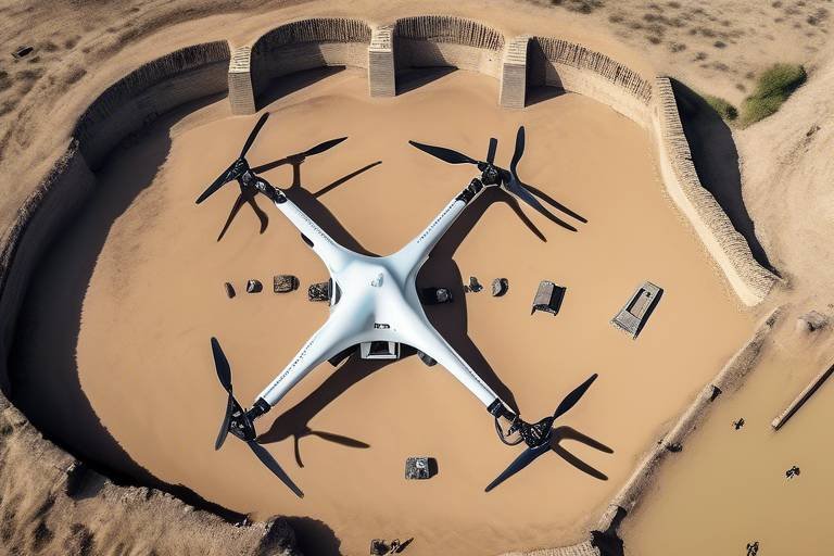
Enhanced Aerial Surveying
Exploring how drones revolutionize archaeological surveys, mapping, and research methods, enhancing efficiency, accuracy, and accessibility in excavations.
Drones have transformed the way archaeologists conduct aerial surveys, providing a bird's eye view of archaeological sites with unparalleled precision. By capturing high-resolution images from above, drones enable researchers to identify buried structures and artifacts without the need for extensive physical excavation. This non-invasive approach allows for a comprehensive assessment of the site's layout and features, all while minimizing disturbance to the delicate archaeological layers below.

3D Mapping and Modeling
Exploring how drones revolutionize archaeological surveys, mapping, and research methods, enhancing efficiency, accuracy, and accessibility in excavations.
Utilizing drone technology to create detailed 3D maps of archaeological sites, aiding in visualization and analysis of historical landscapes. Drones equipped with high-resolution cameras capture images from multiple angles, allowing for the reconstruction of sites in three dimensions. This technology provides archaeologists with a comprehensive view of the terrain, structures, and artifacts, enabling them to analyze spatial relationships and uncover hidden details that may not be visible in traditional two-dimensional maps.
By employing photogrammetry techniques, drones can stitch together thousands of images to generate accurate 3D models with precise measurements. These models offer a virtual representation of archaeological sites, allowing researchers to explore the terrain from different perspectives and simulate various scenarios. The detailed 3D maps created by drones enhance the documentation and interpretation of archaeological findings, providing valuable insights into past civilizations and historical contexts.
Moreover, the integration of 3D mapping and modeling in archaeology facilitates collaboration among experts from diverse fields, such as geospatial analysis, architecture, and conservation. By sharing interactive 3D models online, researchers can engage with a global audience and solicit feedback on their interpretations, fostering a collaborative approach to studying and preserving cultural heritage.

Site Documentation and Preservation
Site documentation and preservation play a crucial role in the field of archaeology, ensuring that valuable historical sites are accurately recorded and protected for future generations. Drones have significantly transformed the way archaeologists approach site documentation and preservation, offering innovative solutions to age-old challenges.
One of the key advantages of using drones for site documentation is their ability to capture precise data without the need for physical intervention. Traditional methods often involve extensive excavation and handling of delicate artifacts, increasing the risk of damage to the site. With drones, archaeologists can obtain high-resolution aerial images that provide detailed information about the layout and features of the site without disturbing the fragile remains.
Moreover, drones enable archaeologists to create comprehensive 3D models of archaeological sites, allowing for detailed analysis and visualization of the landscape. By combining aerial photographs and advanced mapping technologies, researchers can reconstruct the site in a digital format, preserving its current state for future reference.
Furthermore, drones contribute to the preservation of archaeological sites by minimizing human impact. By conducting aerial surveys and documentation, archaeologists can monitor the condition of the site over time and identify any potential threats or deterioration. This proactive approach to site preservation helps in implementing timely conservation measures to safeguard the historical significance of the site.
In addition to documentation, drones also aid in the protection of archaeological sites from external threats such as looting, vandalism, and natural disasters. Regular aerial surveillance allows researchers to monitor unauthorized activities around the site and take necessary precautions to prevent damage or theft of valuable artifacts.
Overall, the integration of drones in site documentation and preservation not only enhances the efficiency and accuracy of archaeological surveys but also contributes to the long-term conservation of cultural heritage. By leveraging drone technology, archaeologists can ensure that valuable historical sites are documented, protected, and preserved for future generations to explore and appreciate.

Remote Sensing and Thermal Imaging
Exploring how drones revolutionize archaeological surveys, mapping, and research methods, enhancing efficiency, accuracy, and accessibility in excavations.
When it comes to uncovering hidden treasures beneath the earth's surface, drones equipped with advanced sensors play a crucial role. These technological marvels are not just flying cameras but sophisticated tools that can detect underground features and variations in soil temperature. By utilizing remote sensing and thermal imaging capabilities, archaeologists can unveil hidden archaeological remains that were once invisible to the naked eye.
Imagine a drone soaring gracefully over a historical site, capturing thermal images that reveal anomalies beneath the ground. These thermal signatures can indicate the presence of buried structures or artifacts, guiding archaeologists to potential excavation sites with pinpoint accuracy. The ability to see beyond the visible spectrum empowers researchers to uncover ancient mysteries that have long been shrouded in secrecy.
Furthermore, thermal imaging assists in identifying subsurface features by detecting variations in soil temperature. This technology enables archaeologists to map out underground structures without the need for invasive excavation, preserving the integrity of the site while unraveling its hidden past. By harnessing the power of remote sensing and thermal imaging, archaeologists can delve deeper into the earth's layers and unveil the secrets that lie beneath.
1. Are drones widely used in archaeological research today?
2. How do drones help in protecting archaeological sites?
3. What are the ethical considerations associated with using drones in archaeology?

Monitoring and Protection
Exploring how drones revolutionize archaeological surveys, mapping, and research methods, enhancing efficiency, accuracy, and accessibility in excavations.
When it comes to monitoring and protecting archaeological sites, drones play a crucial role in ensuring the preservation of these historical treasures. By utilizing drones for regular aerial surveillance, archaeologists can keep a watchful eye on sites to prevent looting, vandalism, and damage caused by natural disasters.
Imagine a scenario where a drone hovers over an ancient site, capturing real-time footage and detecting any unauthorized activity. This ability to monitor from above provides a level of protection that was previously challenging to achieve. Drones act as silent guardians, patrolling the skies to safeguard our heritage.
In addition to monitoring, drones aid in the swift response to potential threats. If suspicious behavior is detected, archaeologists can take immediate action to secure the site, thanks to the rapid deployment capabilities of drones. This proactive approach helps in mitigating risks and ensuring the safety of archaeological treasures.
Moreover, drones contribute to the documentation of site conditions over time. By capturing aerial images regularly, archaeologists can track changes, assess environmental impacts, and implement necessary conservation measures. This continuous monitoring not only protects the sites in the present but also guides future preservation efforts.
Furthermore, drones enhance the efficiency of site protection by covering large areas quickly and cost-effectively. Traditional ground patrols are limited in scope and resources, whereas drones offer a bird's-eye view that spans vast territories with ease. This comprehensive coverage minimizes blind spots and strengthens the overall security measures in place.
1. Are drones commonly used in archaeological research?
2. How do drones contribute to the preservation of archaeological sites?
3. What are the main challenges faced when integrating drone technology in archaeology?

Data Analysis and Interpretation
Data analysis and interpretation play a crucial role in extracting meaningful insights from archaeological data collected through drone technology. By harnessing the power of advanced analytical tools, archaeologists can delve deep into the information captured by drones to unravel the mysteries of the past. Through the meticulous examination of aerial images, 3D models, and sensor data, researchers can uncover hidden patterns, connections, and historical contexts that may have eluded traditional excavation methods.
One of the key advantages of using drones for data collection is the ability to gather vast amounts of information in a relatively short period. This wealth of data presents both opportunities and challenges for archaeologists, requiring sophisticated analytical techniques to sift through the noise and pinpoint significant findings. By employing statistical analysis, spatial mapping, and machine learning algorithms, researchers can identify trends, anomalies, and correlations within the archaeological dataset, leading to novel interpretations and hypotheses.
Moreover, the integration of drone-captured data with Geographic Information Systems (GIS) enables archaeologists to create interactive maps, visualizations, and reconstructions of ancient sites with unprecedented detail and accuracy. These digital tools not only aid in the visualization of spatial relationships but also facilitate the comparison of multiple datasets over time, allowing researchers to track changes in archaeological landscapes and cultural patterns.
In the realm of data interpretation, archaeologists must exercise caution and critical thinking to avoid misinterpretations or oversimplifications of complex archaeological data. By cross-referencing drone imagery with ground-truthing surveys and historical records, researchers can validate their findings and ensure the reliability of their interpretations. This multidisciplinary approach, combining technological innovation with traditional archaeological methods, enhances the credibility and rigor of archaeological research in the digital age.